Skip to content

Showcase

See what people build with PaintMyMap. These examples highlight different styles, projections, and use cases.

Editorial and reports

  • Population density by region — legend‑driven choropleth with labels and title
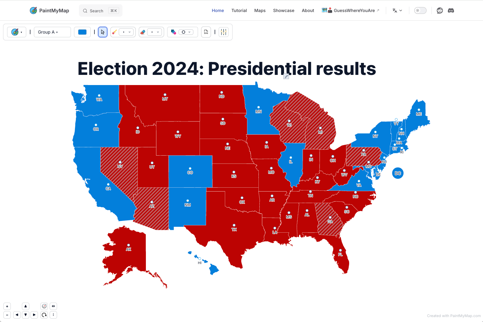
  • Election results map — grouped by party with custom legend and background
PaintMyMap.com: Election 2024: Presidential results
Election 2024: Presidential results created with PaintMyMap.com
CNN: Election 2024: Presidential results

Education and classroom

  • Geography quiz sheet — labeled regions with grid and geo lines
  • History map — visualize countries and describe conflicts better

Travel and tourism

  • Trip itinerary — highlighted countries with a draggable legend and title
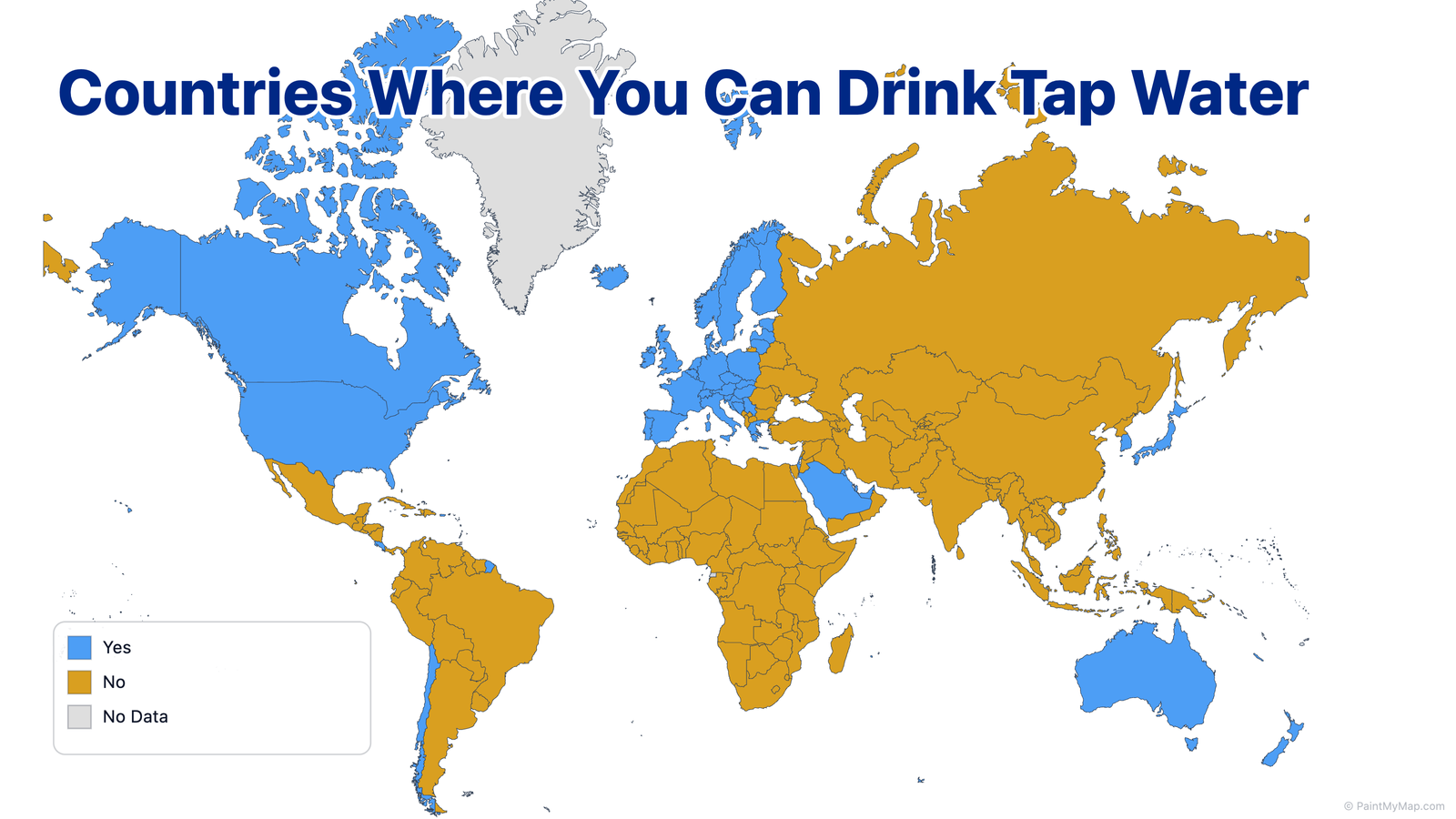
  • Safety Visualization: You Can Drink the Tap Water in These Countries
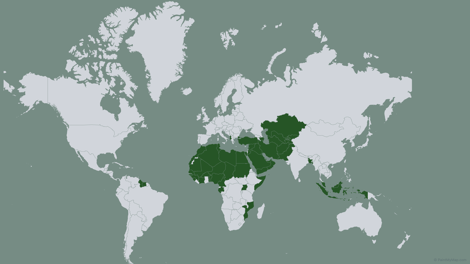
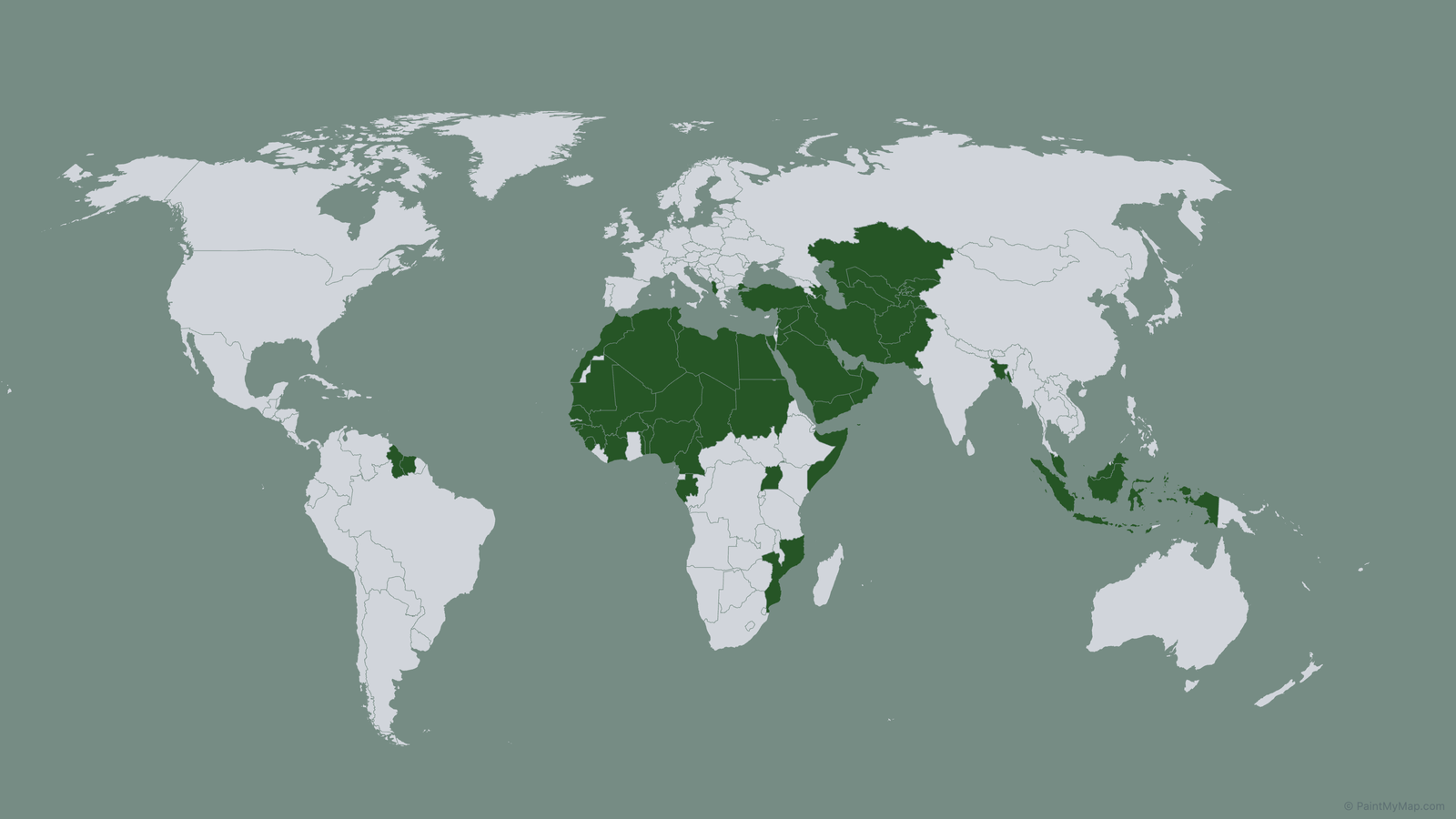
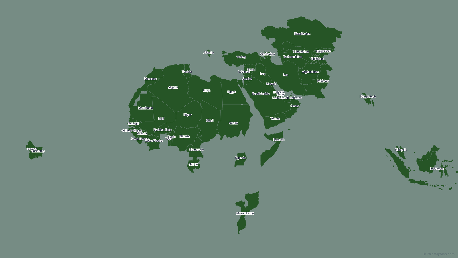
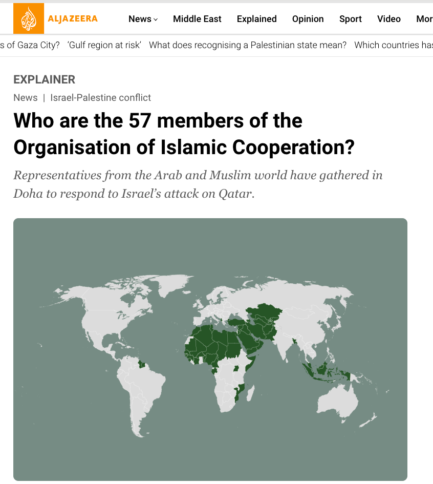
Countries Where You Can Drink Tap Water
Based on The Centers for Disease Control and Prevention (CDC)

Press

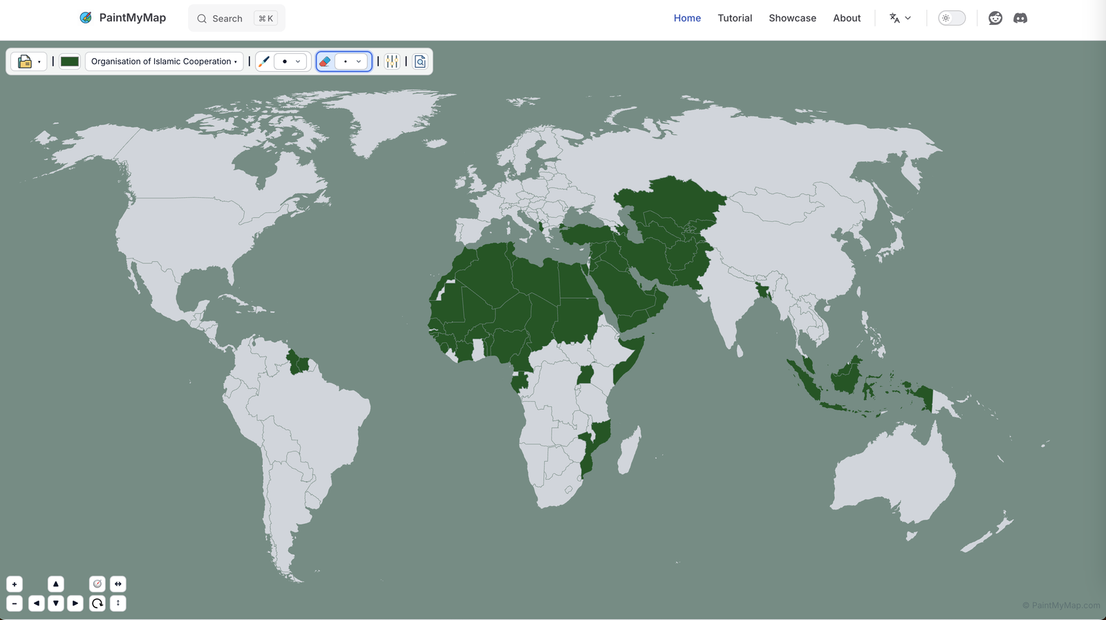
Use PaintMyMap in press visualizations! Like in this example for the Organisation of Islamic Cooperation:

Screenshot of the Organisation of Islamic Cooperation map visualization
PaintMyMap screenshot
Mercator projection map of Organisation of Islamic Cooperation members
Mercator projection
World map highlighting Organisation of Islamic Cooperation countries
Natural Earth projection
Simplified map showing only Organisation of Islamic Cooperation member countries
Painted countries only
Aljazeera: Who are the 57 members of the Organisation of Islamic Cooperation?
Al Jazeera article

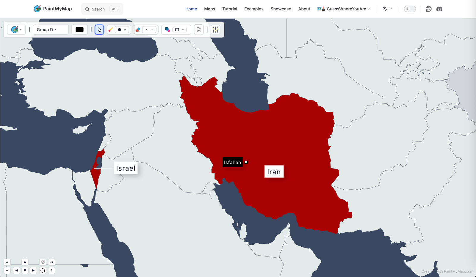
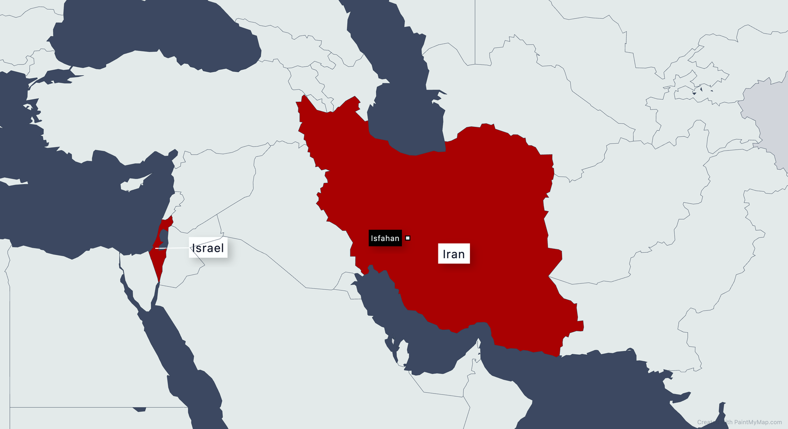
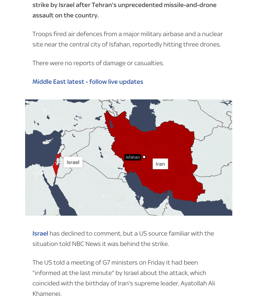
Sky News: Iran Isfahan Attack Example

Map in production
Map in production
Exported map
Exported map
Iran calls Israeli strike 'infiltration' as it downplays attack on Supreme Leader's birthday
Sky News article

Have you used PaintMyMap in your publication? Share a link and we’ll add it here.

Updated at: